Leveling Survey

.
Leveling Survey Services by Kongunadu Surveyor – Expert Land Surveyors in Coimbatore
What is a Leveling Survey?
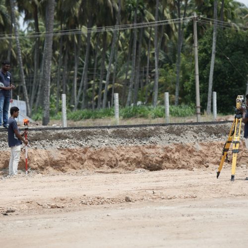
A Leveling Survey is a fundamental surveying method used to measure and establish the elevation between two points on the Earth’s surface. Given that the Earth is an oblique spheroid, the level surface is always curved rather than a plane. This type of survey determines vertical height differences compared to a horizontal line of sight, making it essential for construction, roadwork, railway planning, and various civil engineering applications.
At Kongunadu Surveyor, we specialize in precise leveling survey services in Coimbatore, ensuring accuracy and reliability in every project. Whether for infrastructure projects or small-scale land developments, our expert land surveyors in Coimbatore offer unparalleled expertise in elevation measurement and land assessment.
Types of Leveling Surveys We Offer
1. Barometric Leveling
This is a quick leveling technique where we use a barometer to determine elevation changes based on atmospheric pressure variations. Since atmospheric pressure decreases with altitude, this method is effective for obtaining a general estimation of elevation differences over large distances.
2. Profile Leveling
Before the construction of roads, railways, and other linear engineering works, our land surveyors in Coimbatore perform profile leveling to determine the elevations along the centerline of a proposed project. This ensures that the site is appropriately graded for construction, optimizing safety and efficiency.
3. Reciprocal Leveling
Used in cases where obstacles such as rivers prevent direct leveling, reciprocal leveling ensures that height differences between points are measured with high precision. Our team employs this method when the distance is too long to maintain balanced line-of-sight measurements.
4. Differential Leveling
Our leveling survey services in Coimbatore include differential leveling, which determines the reduced level (RL) of different points. This method is commonly used to establish benchmarks for construction projects and land development.
5. Precise Leveling
For large-scale government and industrial projects, precise leveling is employed to establish benchmarks with exceptional accuracy. Our experts use this method for creating Geodetic Survey and GST benchmarks required by government agencies.
6. Longitudinal Leveling
Longitudinal leveling records the undulations and variations in ground surface elevation along a proposed project’s centerline. This is a critical component in planning highways, railways, and canals.
7. Cross Leveling
To assess elevation variations on either side of a project’s centerline, we perform cross-leveling surveys. This technique is vital in computing the quantities of earthwork needed for excavation and land grading.
8. Simple Leveling
This basic method determines the difference in elevation between two points using a leveling instrument. It is frequently used for smaller projects requiring straightforward height assessments.
9. Fly Leveling & Check Leveling
Fly leveling is a differential leveling technique that connects a benchmark to the starting point of a project’s alignment. At the end of each workday, check leveling is performed to verify and ensure consistency in elevation readings, reducing the chances of errors in subsequent work.
Why Choose Kongunadu Surveyor for Leveling Survey Services?
- Expert Land Surveyors in Coimbatore – With years of experience, our team is highly skilled in executing all types of leveling surveys with unmatched accuracy.
- Advanced Surveying Equipment – We use state-of-the-art instruments such as auto-levels, theodolites, and digital leveling devices to ensure precise measurements.
- Reliable & Timely Results – Our streamlined surveying process ensures that projects are completed on time without compromising quality.
- Government-Approved Surveying Methods – We adhere to industry standards and government regulations, ensuring compliance with project requirements.
- Custom-Tailored Solutions – Whether you require elevation mapping for a small plot or large-scale infrastructure development, we offer solutions tailored to your specific needs.
Applications of Leveling Surveys
- Road and Railway Construction – Ensuring even elevation for safe and efficient transportation networks.
- Land Development Projects – Establishing benchmarks for residential and commercial land development.
- Canal and Drainage Planning – Determining slopes for effective water flow management.
- Bridge and Tunnel Construction – Ensuring accurate height differentials for structural stability.
- Mining and Excavation Work – Assessing elevation changes to aid in excavation planning.
- Agricultural Land Grading – Leveling farmland for optimized irrigation and crop growth.

We are dedicated to providing top-tier Digital Land Surveying Services with accuracy, efficiency, and integrity.
We understand that land is one of the most valuable and permanent assets, and we take pride in offering precise surveying solutions that contribute to sustainable development and proper land management.
Services
Services
Address
Head Office
No:93, Sarojini Street,
Ram nagar,
Coimbatore-641009.
Branch Office
Pondicherry
No 50, 1st Floor, E.C.R. Opp. To N.T. Mahal,
Ellaipillaichavady
Puducherry, 605005.
